Where We Operate and Why
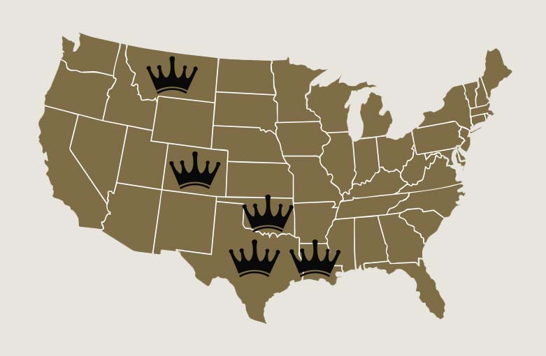
Texas Playbook
Crown is active in Jackson County with the Crown Rose #1 Joint Venture. This south Texas project is a single vertical well drilled to approximately 6,700 feet to test a seismic anomaly in the Yegua sandstone. This formation is Eocene in age and is easily identifiable in our prospect area using seismic technology. A gas-filled reservoir can be reflected in seismic readings as a “hot spot” or “bright spot”. This is evident in our prospect area. The Upper Yegua is our objective here.
Additionally, we have oil and gas wells in Ochiltree County with a number of Cleveland Joint Ventures. These horizontal wells located outside of Perryton are part of a trend that has been developed by Crown over several years. On average, the wells were drilled vertically approximately 6,750 feet and then turned lateral approximately 3,500 feet. This region has been developed since the 1950s. Vertical wells were primarily drilled for the deeper Morrow Sands. However, with the introduction of horizontal technology, formations that were not economic suddenly became the target of exploration. One of these intervals is our targeted Cleveland Sand.
The Austin Chalk well continues to consistently produce in Frio County, Texas. This trend extends from southwest Texas across the entire state approximately 500 miles,and further extends through Louisiana. The Austin Chalk area has experienced numerous periods of development as technology and completion procedures have improved.
Oklahoma Playbook
We are active in Major County with the Crown Shamrock #1, #2, #3, #4, and #5 Joint Ventures and continue to produce from this play in the Hunton Formation with horizontal oil and gas wells. These wells are typically drilled vertically to approximately 8,700 feet, then lateral approximately 5,000 feet. The target is the prolific Hunton Formation which reaches a thickness of 350-400 feet in the region. This region has been developed vertically for over 50 years from the Hunton and shallower oil zones. The Hunton Formation in this area is highly fractured with the fractures trending east to west. Our laterals are typically drilled due north to south in an attempt to intersect as many natural fractures as possible in the overlooked Hunton pay zone.
We are also applying new technology to the proven Arkoma Basin in Atoka County, which is situated in southeast Oklahoma. These wells will be drilled vertical to approximately 12,900 feet, then lateral approximately 12,300 feet to a Total Measured Depth of 25,200 feet. The target is the prolific Woodford Formation which reaches a thickness of 110-200 feet in the region. The Woodford has produced billions of cubic feet of gas from two wells within the section. this region has been developed vertically from shallower zones for more than 50 years. The first horizontal wells in the basin were drilled in 2004. Today's more modern drilling and completion techniques make this area a focal point in Crown's development strategy.
Colorado Playbook
With the Crown Niobrara #1, #2, #3, and #4 Joint Ventures active in Weld County, we are excited about our continued expansion in Colorado. These horizontal oil and gas wells northeast of Denver targeted the Niobrara Formation. They were drilled approximately 6,000 feet vertical, then horizontal approximately 9,000 feet. The Niobrara Formation has approximately 250 feet thickness in this area and consists of limestone, chalk, and Marl sections. Over the past 75 years, Operators have drilled for the deeper D and J Sands and noticed gas shows as they drilled through the shallower Niobrara Formation, but the low permeability rock was nonproductive with the old conventional vertical wells. However, all of those wells have now given geologists an abundance of data to define the limits of the Niobrara oil and gas pay zones. Modern horizontal and fracture technology applied to this tight rock has proven to be the game changer for the Niobrara play.
Montana Playbook
Our Crown Titan #1 and #2 Joint Ventures are active in Toole County. These horizontal oil and gas wells, each treated with multiple-stage frac technology, targeted the Nisku Formation. They were drilled approximately 3,300 feet vertical, then more than 4,000 feet lateral. The Nisku Formation in this area is approximately 60-80 feet in thickness with a main porosity interval of 10-20 feet thickness. This sucrosic dolomite has 6-20 percent porosity with exceptional permeability. Scattered vertical production, drilled decades ago, either produced naturally or with acid and were not sand fractured. For this reason, we believe oil and gas was left behind by not utilizing larger stimulations with sand fracture technology in the Nisku Formation.
